


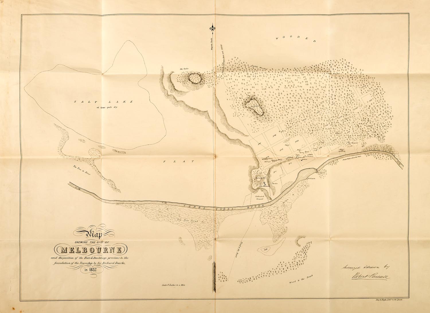
Lot #181 - Russell, Robert. Map shewing the site of Melbourne and the position of the huts & buildings
-
Auction House:Mossgreen
-
Sale Name:The Denis Joachim Collection
-
Sale Date:19 Jun 2016 ~ 2pm - Session 1: Lots 1 - 321
20 Jun 2016 ~ 10am - Session 2: Lots 322 - 480
20 Jun 2016 ~ 2pm - Session 3: Lot 481 - 688
20 Jun 2016 ~ 6pm - Session 4: Lots 689 - 818 -
Lot #:181
-
Lot Description:Russell, Robert. Map shewing the site of Melbourne and the position of the huts & buildings
previous to the foundation of the township by Sir Richard Bourke in 1837. Lithographed map, approximately 475 x 650 mm, laid down on linen at an early date and folded within a cloth slipcase, small release stamp of the Bodleian Library on the linen back. London, Day & Haghe, [1837]. -
Notes:The very rare first map of Melbourne. Russell’s quite detailed map shows the commandant’s residence, church, store, numbered town allotments, dwellings with the owners’ names, tracks, and many natural features. While it is perhaps too harsh a judgement, it might be said that this Melbourne map was Russell’s only substantial achievement in fulfilment of his instructions for the survey of the Port Phillip District. Billot 122a; not in Tooley.
-
Estimate:A$12,000 - 18,000
-
Realised Price:
-
Category:Books & Manuscripts
This Sale has been held and this item is no longer available. Details are provided for information purposes only.