


Lot #774 - “Chart of part of the SOUTH SEA
-
Auction House:Mossgreen
-
Sale Name:Australian & Colonial - Antique & Historial
-
Sale Date:09 Nov 2015 ~ Session 1: 10.30am (Lots 501 - 815)
09 Nov 2015 ~ Session 2: 2pm (Lots 816 - 1105) -
Lot #:774
-
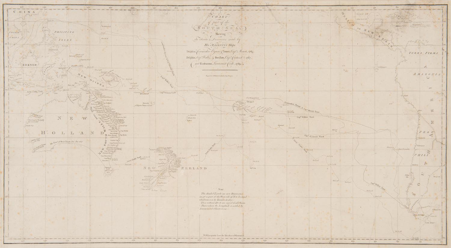
Lot Description:“Chart of part of the SOUTH SEA
shewing the tracts & discoveries made by HIS MAJESTYS Ships Dolphin ...& Tamer....1765, Dolphin...& Swallow...1767, and Endeavour, Lieutenant Cooke, 1769. engrav’d by W. Whitchurch, Pleasant Row Islington.” Several charts were made during Cook’s epic first voyage, many of them published in Hawkesworth’s account of the voyage. This map of the Pacific is the second published map to show the east coast of Australia charted and the second to show New Zealand in its entirety. Only Vaugondy’s map published weeks before shows an earlier depiction. -
Notes:Cook’s discoveries and tracks are marked in great detail both in New Zealand and Australia. Attention is given to the plotting of his track with regular compass readings noted along the entire route. Noted also are the various dates that land was sighted. The map details the many place names that Cook gave for locations he visited up the entire length of the coast, from the first landing at ‘Point Hicks’ to ‘Shelburn Bay’ at the top of Cape York Peninsula. On New Zealand, Cape South (Stewart Island) is shown as part of the South Island and not as an island as it should be.
-
Estimate:A$1,500 - 2,000
-
Realised Price:
-
Category:Books & Manuscripts
This Sale has been held and this item is no longer available. Details are provided for information purposes only.