


Lot #451 - A Collection of Maps and Aerial Photographs Documenting Australia's Involvement in New Guinea during WW II.
-
Auction House:Bay East Auctions
-
Sale Name:The Art & Book Sale
-
Sale Date:27 May 2012 ~ 2pm
-
Lot #:451
-
Lot Description:A Collection of Maps and Aerial Photographs Documenting Australia's Involvement in New Guinea during WW II.
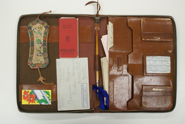
Japan's defeat in the Battle of Coral Sea (1942) prompted it to establish beach heads at Buna, Gona and Sananada in an attempt to capture Port Moresby by land (via the Kokoda Trail), rather than by sea. Australia's fighting forces (army, air force and navy) made a vital contribution to the Allied counter-offensives in New Guinea under the direction of the Commander of the Australian Military Forces, General Sir Thomas Blamey, often fighting in difficult terrain and under appalling conditions. This fascinating collection of maps and aerial photographs, assembled by Lieutenant Colonel Charles Raymond Stoddart (who attained the highest rank in the Australian Survey Corps during WWII), documents Australian and Japanese activity in New Guinea and the surrounding areas during that time. Stoddart's involvement in the New Guinea Campaigns culminated in his being presented with the 'Instrument of Surrender of the Japanese forces in New Guinea, New Britain, New Ireland, Bougainville and adjacent islands'. During his service in New Guinea, Stoddart perused secret and confidential intelligence reports, as well as being engaged in map-making of the local rugged terrain and interpreting aerial photographs of enemy positions. Many of the aerial photographs listed in the collection were used in compiling detailed maps of the region. The collection includes: o 18 captured maps (1:100,000, published in May1945) surveyed and drawn by the Japanese Imperial Army of their strategic stronghold on the Gazelle Peninsula, New Britain. Marked 'Gunji Himitsu' (Military Secret) o A double-sided map of Lae and Malahang Aerodromes dated 1943 showing the compass readings indicating magnetic bearings towards the target. The verso shows in fine detail the enemy's gun placements at Lae Aerodrome. o Two maps of Lae (1/25000) surveyed with the aid of air photographs by 2 Aust Field Survey Coy, Aust Survey Corps, Mar' 44 (second edition). One is signed in pencil by the then Major Stoddart and includes hand-drawn placements of the survey directorate, First Aust Army and 2 Aust Fd Svy Coy (No 3 sec). The second map is unsigned with no added hand-drawn placements. o A large coloured map of the Pacific Ocean (scale 1: 35000000, 552.4 miles to 1 inch at the Equator) compiled and drawn in the cartographic section of the National Geographic Society for the National Geographic Magazine. 'For official use only of the British War Office' is printed on the top right hand corner, with 'Published by War Office, 1943' printed lower left. o A large, detailed Australian Aeronautical map (sheet B.9) provisional edition revised September 1943 (equatorial scale 1: 1000000) of New Britain and New Ireland. It states that it is for use in daylight or under red light. It also states that all users are to make necessary corrections hereon and return to RAAF. The map is signed in pencil by Major CR Stoddart. o A large map titled Huon Gulf Special New Guinea (scale 1:253440). Control: Field Survey by Aust Svy Corps NGF. Air Photos: 5th Air Force. Compilation: 1 Aust Mob Litho Sec AIF, Aust Svy Corps, Aug 43. Signed in pencil by Major CR Stoddart. o A large map of New Britain Nuginiklub (scale 1:25000 series). Compiled and drawn with the aid of aerial photos by 2 Aust Fd Svy Coy. (AIF) Aust Svy Corps. Feb '45. It also states mission identifications undertaken by the 17th photo Squadron, 13th Air Force. o Two detailed, typed intelligence summary photo reports (double sided) from the headquarters of the Allied Air Forces Southwest Pacific Area Directorate of Intelligence Central Interpretation Unit, both marked British: Secret and U.S.: Confidential. Both are accompanied by annotated mosaics and several aerial photographs. The first report is of the Lae defences, March 1942 to April 1943 and is stamped as being received by military intelligence 28 April 1943, together with a hand-written file number. The second detailed photo report also concerns the Lae area Japanese defences and is stamped as being received by military intelligence 20 May 1943 (hand written file number included). It should be noted that Lae was captured on 16 September 1943. By May 1943 the Allies' objectives were to continue the advance westward to Madang, to seize the Markham Valley (which extends 608 kilometres westward from Lae), and to secure the Huon Peninsula prior to a move eastward to the island of New Britain. o A photographic copy (sketch map 1/12.50 scale) from May 1942 depicting the barracks and vicinity at Port Moresby (Kusunose Unit) drawn from aerial photographs. The map is marked strictly confidential and the annotations are in both English and Japanese. o A collection of six aerial photographs of the Japanese occupation of Wewak, Boram and Madang (all clearly dated/numbered (file), as are all of the photographs in the collection), together with a large annotated mosaic of Wewak, Boram and Moem. The photographs and mosaic were taken in1943. o Six fine annotated aerial photographs of the -
Estimate:A$0 - 0
-
Realised Price:
-
Category:Books & Manuscripts
This Sale has been held and this item is no longer available. Details are provided for information purposes only.