


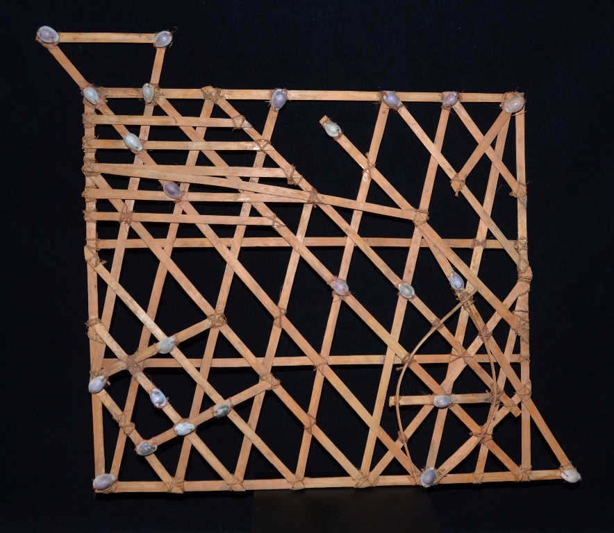
Lot #221 - An early Micronesian Navigational Map
-
Auction House:Theodore Bruce
-
Sale Name:The Todd Barlin Collection of Fine Oceanic & Asian Arts
-
Sale Date:08 May 2016 ~ 12noon
-
Lot #:221
-
Lot Description:An early Micronesian Navigational Map
known as Stick Charts which were used to navigate the Pacific Islands by Canoe. Made from straight and bent pieces of coconut fronds midribs and tied with sennit coconut fibre string, small Cowrie shells are tied in precise spots to identify Islands in the chain to navigate in traditional canoes from Island to Island
43 x 40 cm -
Provenance:C. Barnes collected this map on Truk Island in the 1950's / Todd Barlin Collection.
-
Estimate:A$2,000 - 3,000
-
Realised Price:
-
Category:Tribal
This Sale has been held and this item is no longer available. Details are provided for information purposes only.